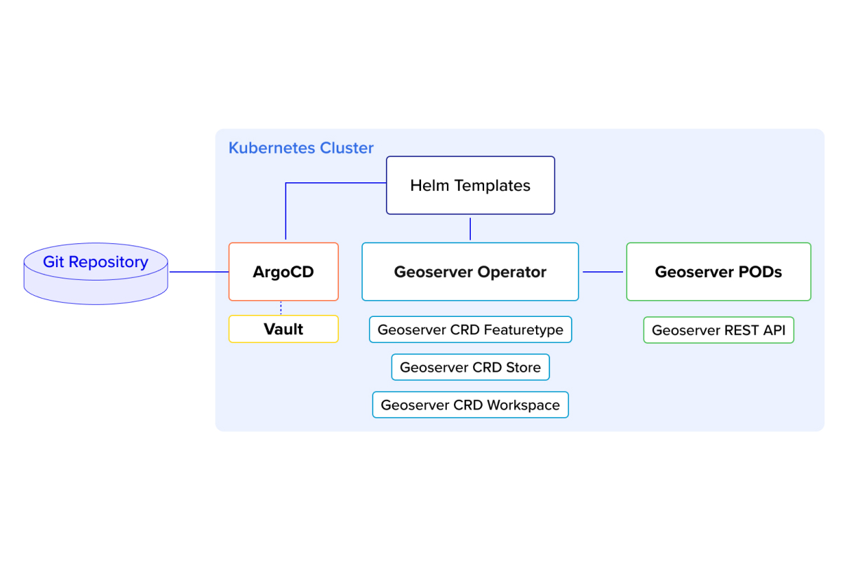
In the ever-evolving landscape of geospatial technology, automation, and scalability have become critical for managing geo-servers efficiently.
Read more


As we move into 2025, Geographic Information Systems (GIS) continue to evolve, becoming more integral to decision-making processes across industries and offering new capabilities and solutions.
Read more


GIS (Geographic Information System) is a powerful tool that enables municipalities to collect, manage, analyze, and map vast geographic data. With GIS, spatial information becomes more accessible, improving many
Read more


International Disaster Risk Reduction Day, celebrated every year on October 13th, emphasizes the critical need for proactive strategies to mitigate the effects of natural hazards.
Read more


Exposure management is crucial for insurance companies to maintain sufficient capital against catastrophic losses. Without carefully balancing their exposures and capital, a single catastrophe can put a company out of business. GIS-powered interactive maps are a powerful tool for visualizing and managing risk
Read more

Data generation is accelerating at an unprecedented rate, with billions of data points being created every hour. As this continues to be produced around the globe, geospatial data (information derived from tools monitoring our world) is increasingly important for many businesses.
Read more
