
Cloud-Native Geospatial Business Intelligence Engine

Automate large-scale geospatial data processing, enrich datasets instantly, and get fast insights for any workflow.

Talk to an expert

Product Capabilities

Massive Processing Power

Handles up to 5 million requests per second per node, scaling effortlessly to meet any workload. RAPID provides instant, validated, and ready-to-use geospatial data, ensuring that large datasets never slow down your operations.

Unified Intelligence Engine

Blends advanced vector and raster processing with powerful business intelligence tools. This engine transforms raw data into strategic insights, enabling precise risk modeling and predictive analytics across millions of locations.

Seamless API Integration

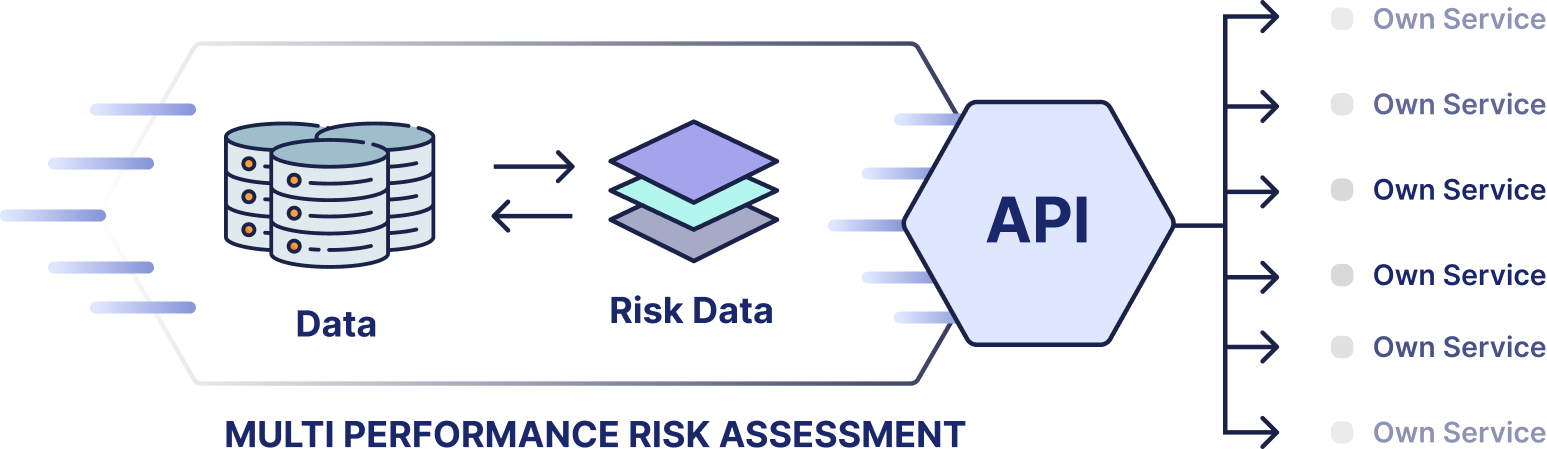
Designed to plug directly into your existing infrastructure. RAPID unifies data from SQL, Oracle, CSVs, and live EventHUB streams through an API-first architecture, allowing for flexible, real-time integration into your current enterprise systems.

Enterprise-Grade Data Quality

Automates data cleansing, validation, and standardization to guarantee high-quality results at scale. Fully MCP-ready, the platform supports AI agents, automated workflows, and the highest standards for enterprise security and compliance.

Proven Results

Zero-Touch Automation
Eliminates manual data processing, reducing human intervention to 0 through full automation.
Massive Processing Scale
Processes 5M+ requests per second per node
for real-time or batch analysis.​
Unlimited Data Capacity
Scales from small datasets to millions of records seamlessly, ensuring zero performance loss or system downtime.
Unified API Integration
Integrates diverse data sources into a single stream, delivering enriched insights directly to your enterprise.

How we compare

Feature
Pricing
Deployment
Processing Speed
Scalability
Integration
RAPID
solution
Flat rate pricing
solution
Pure cloud-native API, no infra
solution
5M+ requests/second/node
solution
Unlimited volume, peak demand
solution
API-first, short setup
Traditional Platforms
Opaque enterprise licenses
Hybrid/on-prem, complex setup
Slower batch processing
Usage caps, overprovisioning costs
Lengthy migrations, vendor lock-in

How we compare

Enterprise-Ready Security & Tech

RAPID is engineered for performance, security, and scalability.
Cloud-Native Stack
Kubernetes-powered on Azure for hybrid/private clouds.
Security & Privacy
Robust data restrictions, access controls, and compliance-ready features.
Proven Infrastructure
API-first integration enabling automated, secure data enrichment at enterprise scale.

RAPID at a glance

A technical diagram titled "Multi Performance Risk Assessment" showing risk data flowing through an API to multiple "Owned Service" modules. The illustration is related to Rapid by Quarticle.

What our customers are saying

“Blazing fast, cost-efficient, and easy to integrate, RAPID empowers our renewal processes and risk modeling. Fully automated geoprocessing and geo-enrichment of smaller books or larger portfolios are no longer an issue. We have reduced the amount of human intervention by more than 300%. From Core Insurance Systems to Scenario Modelling, all are connected and enabled within a short implementation phase.”
Kai Ole Rogge, Former Head of GIS, Global P&C Insurer with 150,000+ Employees
Seeking automated geospatial data enrichment?
Transform datasets at scale with high-performance BI.