Our client is a global leader in reinsurance, and insurance with over 150 years of experience, committed to making the world more resilient. Headquartered in Switzerland, they offer innovative solutions across property and casualty, life and health, and specialty insurance.
.png)
The client’s main objectives were to replace their existing GIS server for improved performance, support open standards, and run on Microsoft Azure’s IaaS and PaaS services. The solution needed to be cloud- and enterprise-ready to manage natural hazard risks and handle monthly and quarterly business peaks on Azure. Additional challenges included:
.png)
Quarticle built the client’s Geo-engine to enable rapid geo lookups and visualization, maintaining the backend mapserver and High-Performance Layer. By scaling to handle 800,000 location requests per second, response speed was significantly boosted. The solution was implemented using Open Source GeoServer with PostGIS, running on Microsoft Azure IaaS and PaaS, and is also compatible with Google Cloud and AWS.
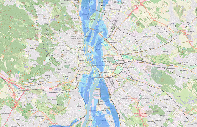
For the second objective, Quarticle developed a workflow to acquire, process, and deliver flood hazard data for Eastern European countries. This involved data downloading, cleaning with QGIS, applying an overlay algorithm using GRASS-GIS to avoid overlapping zones, removing topology errors, and final data export.

Quarticle's geo-engine implementation delivered impactful results for the client. The new GIS server achieved superior performance, supporting open standards and running seamlessly on Microsoft Azure's IaaS and PaaS.
For flood hazard data, Quarticle’s workflow, using QGIS, GRASS-GIS, and ArcMap, ensured clean, standardized, and accurate data for Eastern European regions. The final data was structured and free of topology errors. Overall, Quarticle's solution fully met the client's needs, providing a high-performance, cloud-ready GIS solution.