Quarticle is a unified, Kubernetes-native GeoIntelligence platform that connects data ingestion, spatial processing, analytics, and delivery at scale through standard APIs and AI-ready integrations.
The Quarticle team brings geospatial and industry expertise together with consulting to define use cases, structure underlying data, and translate requirements into concrete data models and processing workflows.
We work with raw geospatial data, curated datasets, and stochastic models, ingesting, normalizing, and enriching them into analysis-ready outputs tailored to each use case.
We design and operate automated data pipelines and processing workflows that ensure consistent execution at enterprise scale, supporting high-volume geospatial workloads.
We run and maintain the platform end-to-end, handling data ingestion, processing, infrastructure, and ongoing system operations.
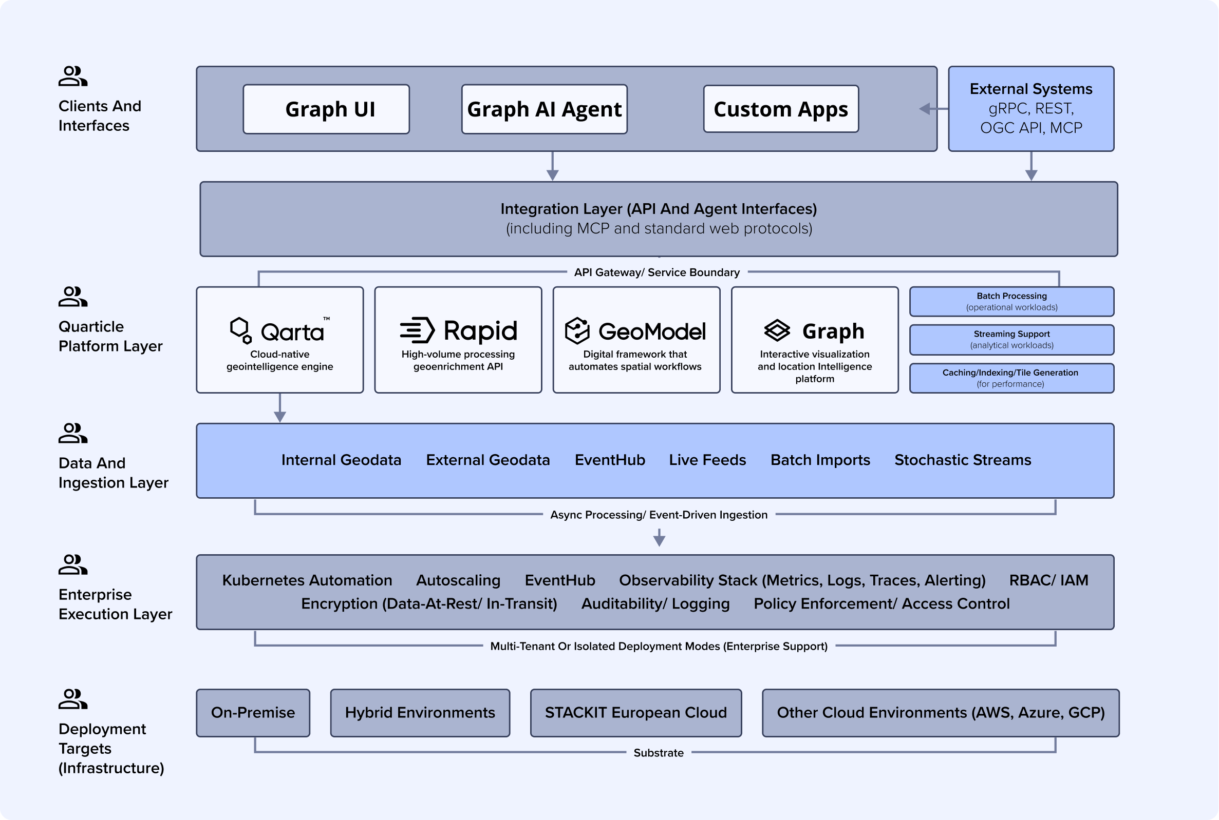
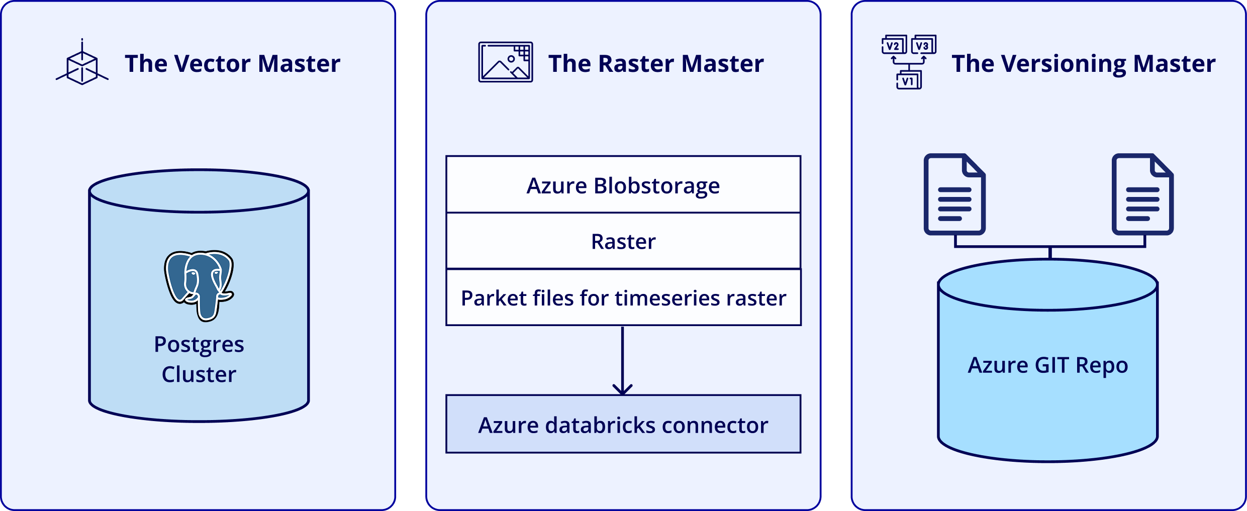
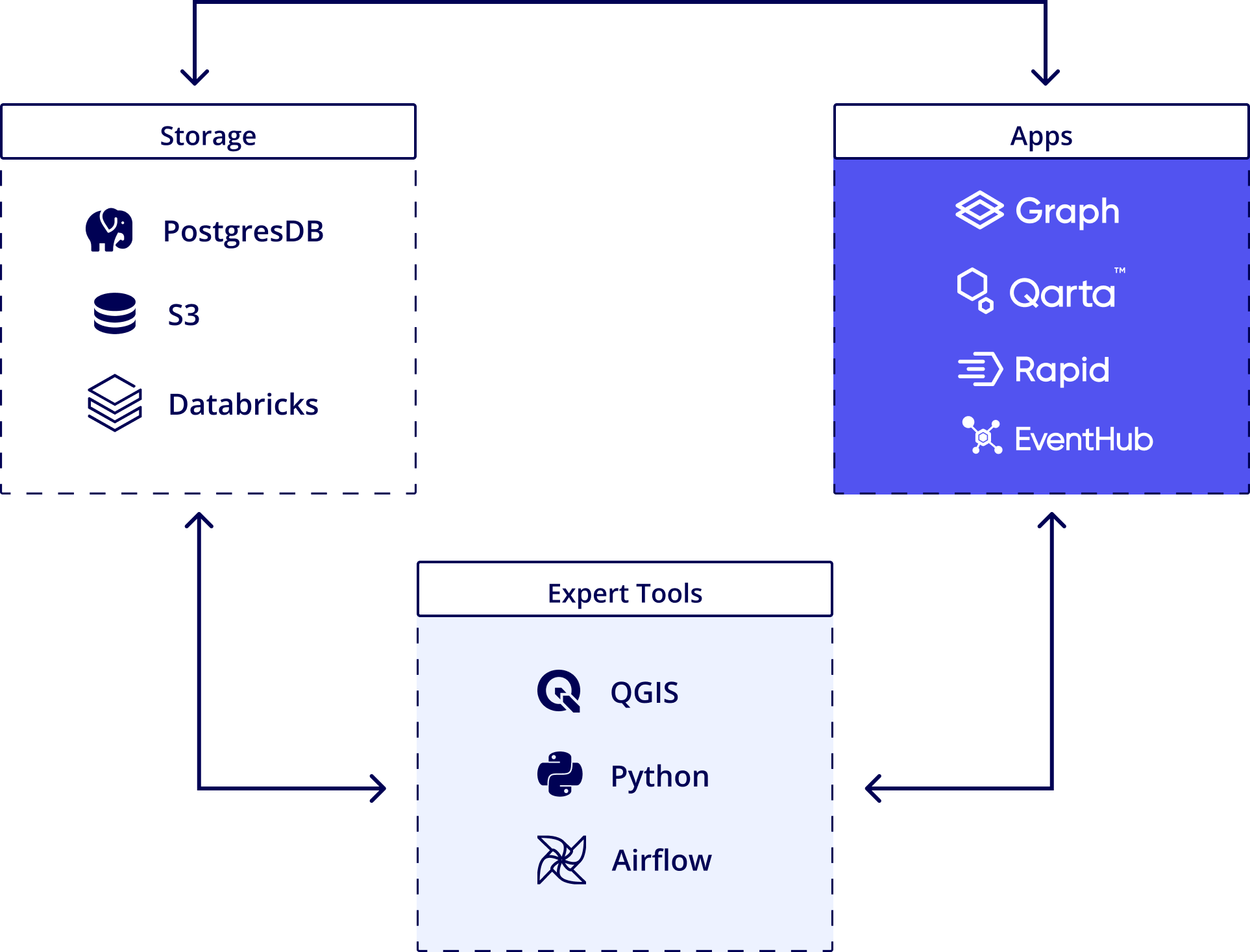
This overview describes the top-level structure of the Quarticle platform, focusing on how data, processing services, and interfaces are organized and connected.
CORE ENGINES
APPLICATIONS



AI & INTEGRATION
INFRASTRUCTURE
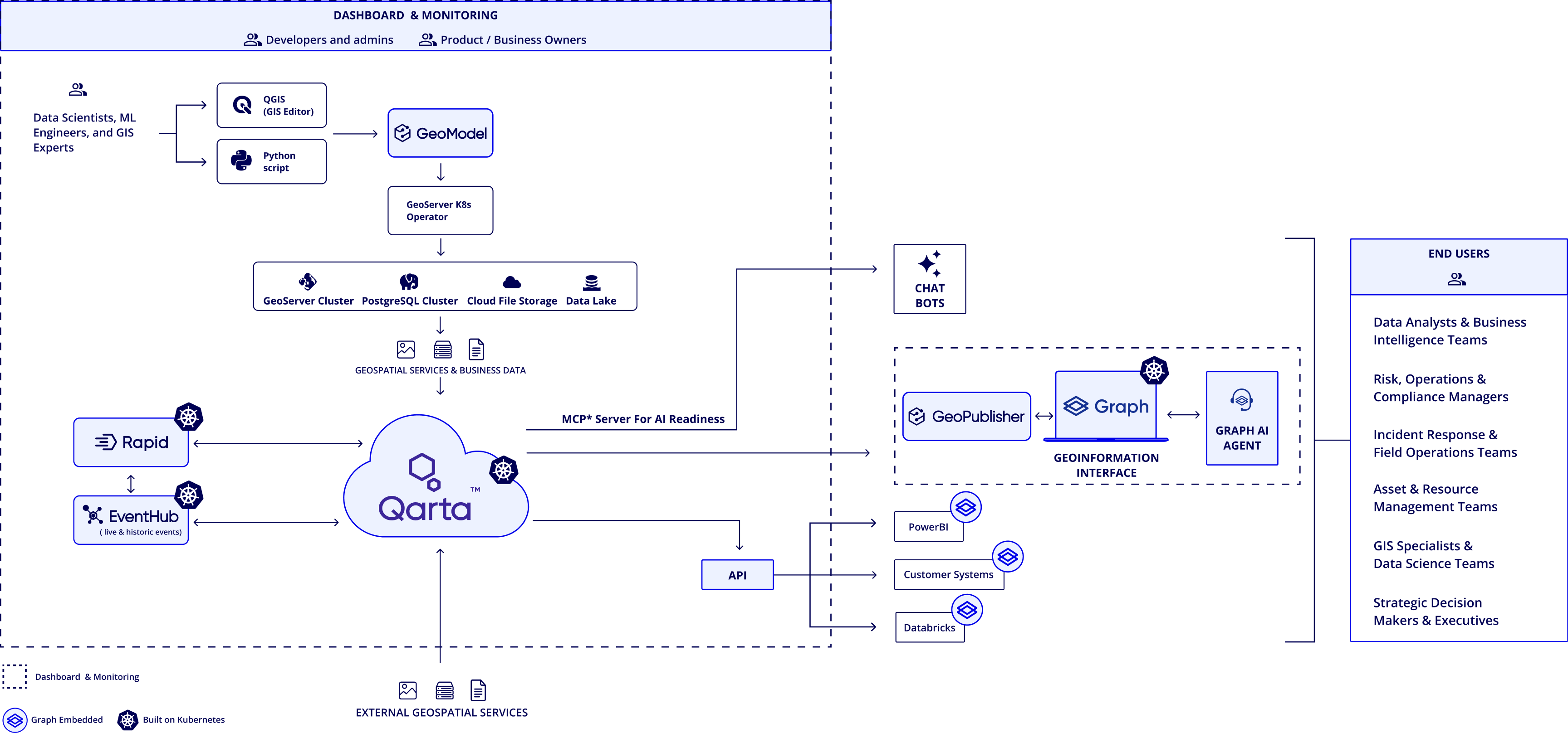
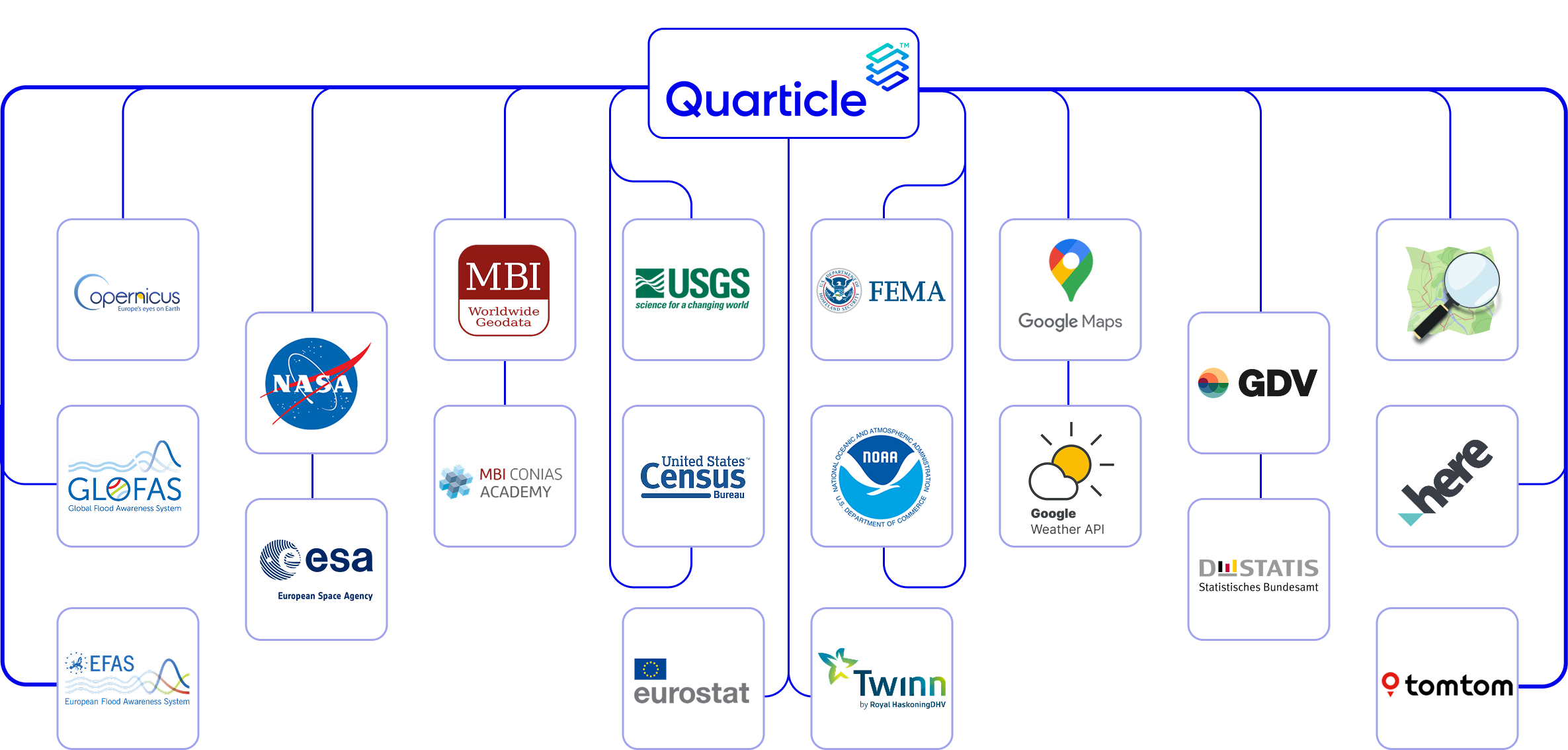
Live event streams, stochastic models, and enterprise data catalogs are unified within the Quarticle geospatial intelligence platform.
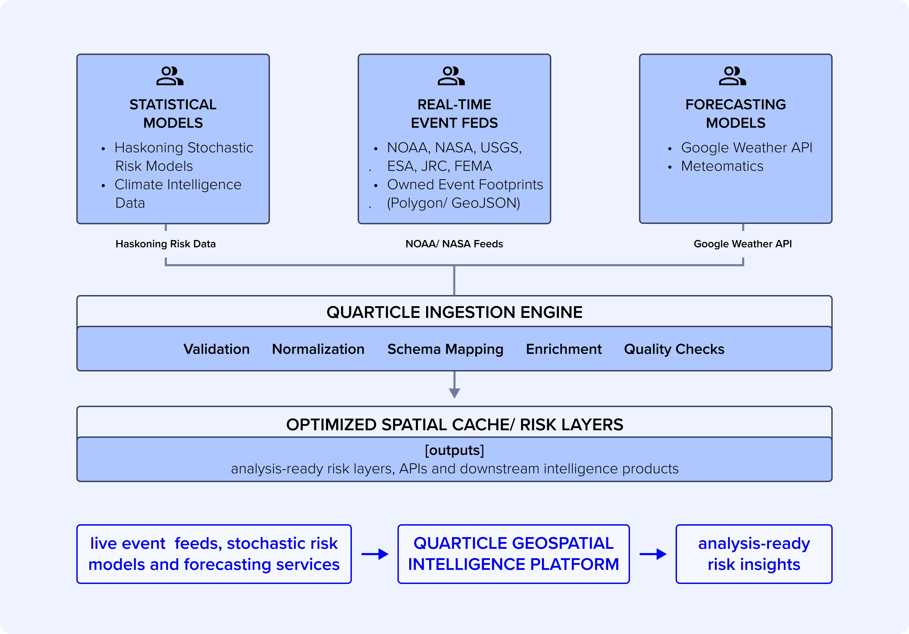
The platform natively ingests, normalizes, and exposes multi-source geospatial feeds across three technical layers:


Multi-endpoint API ingestion from official, authoritative agencies:




Native support for proprietary event footprints via Polygon or GeoJSON.
Atmospheric Matrices:
Real-time integration with Google Weather API and Meteomatics for scenario-based predictive modeling.


High-throughput internal data layers connect seamlessly with Snowflake and Databricks through zero-copy architecture patterns, completely removing manual ETL overhead.

Full backward and forward interoperability with QGIS and ArcGIS Pro is enabled natively through optimized, OGC-compliant feature and tile engines.


Direct streaming connectivity to Power BI supports low-latency access for high-density geospatial visualization and corporate reporting.
A cloud-native geospatial intelligence engine designed to process, serve, and integrate high-volume spatial data at scale. It enables secure, real-time delivery of geospatial services through API-first architecture for enterprise systems and applications.
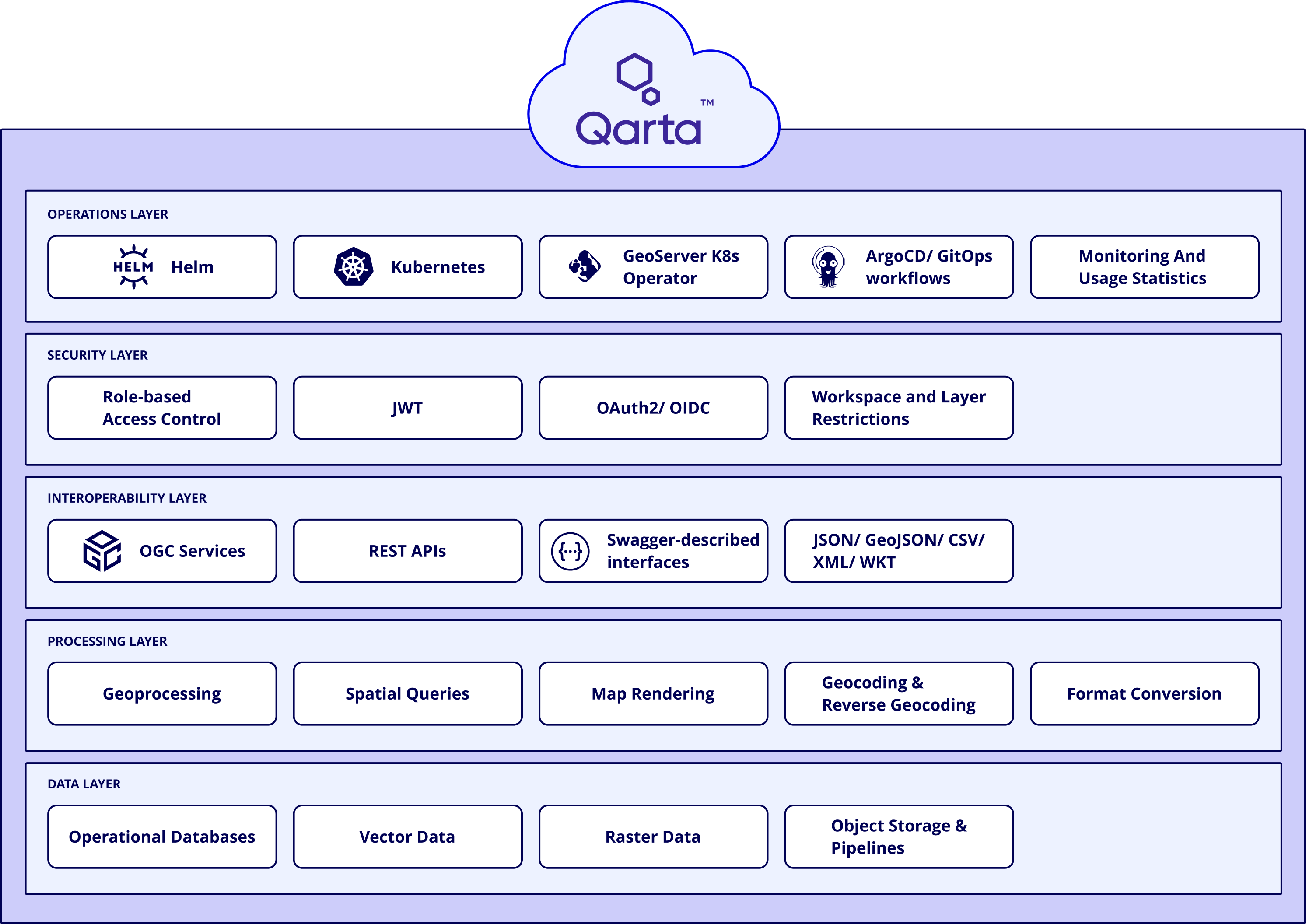
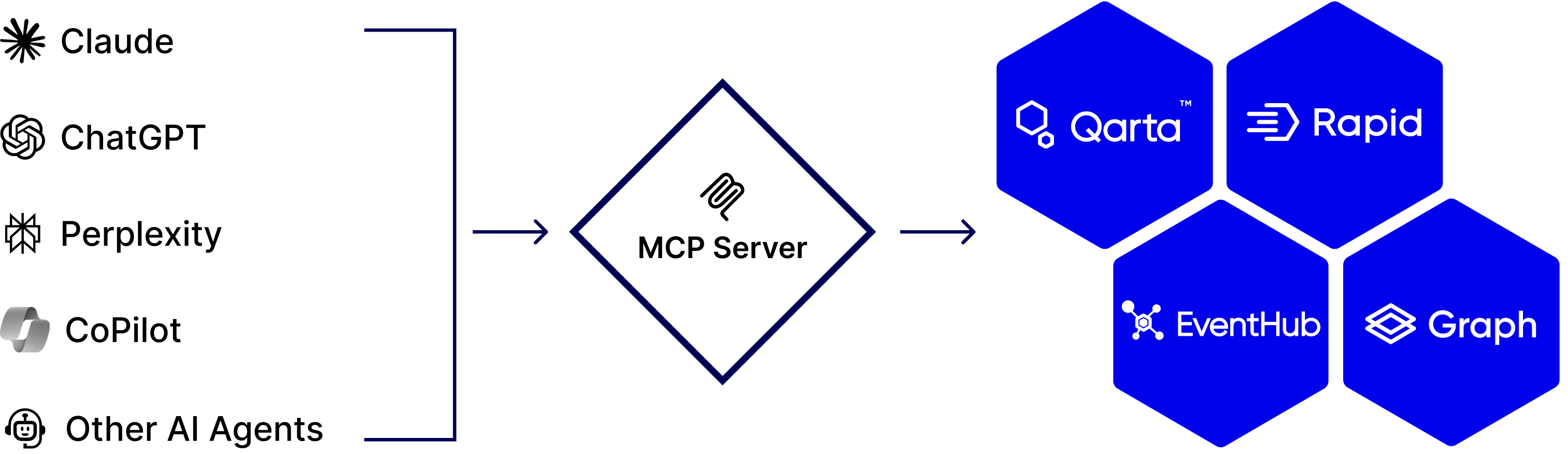
A standardized protocol that enables secure, governed AI access to Quarticle’s cross-product data, services, and capabilities, ensuring consistent context sharing and controlled interaction across systems.
A Kubernetes-based automation layer for managing GeoServer Cloud microservices, streamlining deployment, scaling, and lifecycle operations in cloud-native geospatial environments.
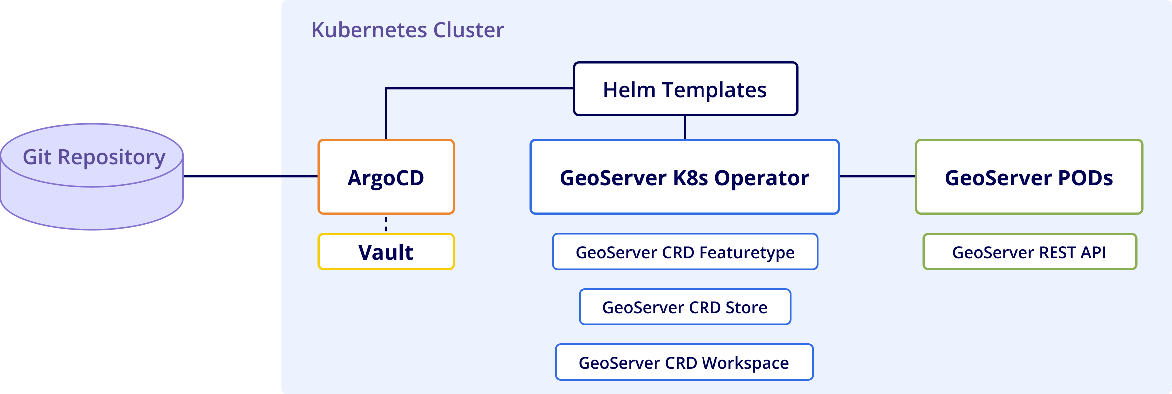
Custom Python-based infrastructure operator developed natively over the Kopf lifecycle framework.
Simplifies GeoServer-Cloud microservice configuration and continuous lifecycle management using Kubernetes-native tooling patterns.
Natively automates and instantiates isolated internal geospatial contexts via custom CRDs:
A cloud-native Kubernetes platform that enables automated deployment, orchestration, and operation of secure geospatial intelligence systems across private and hybrid environments.
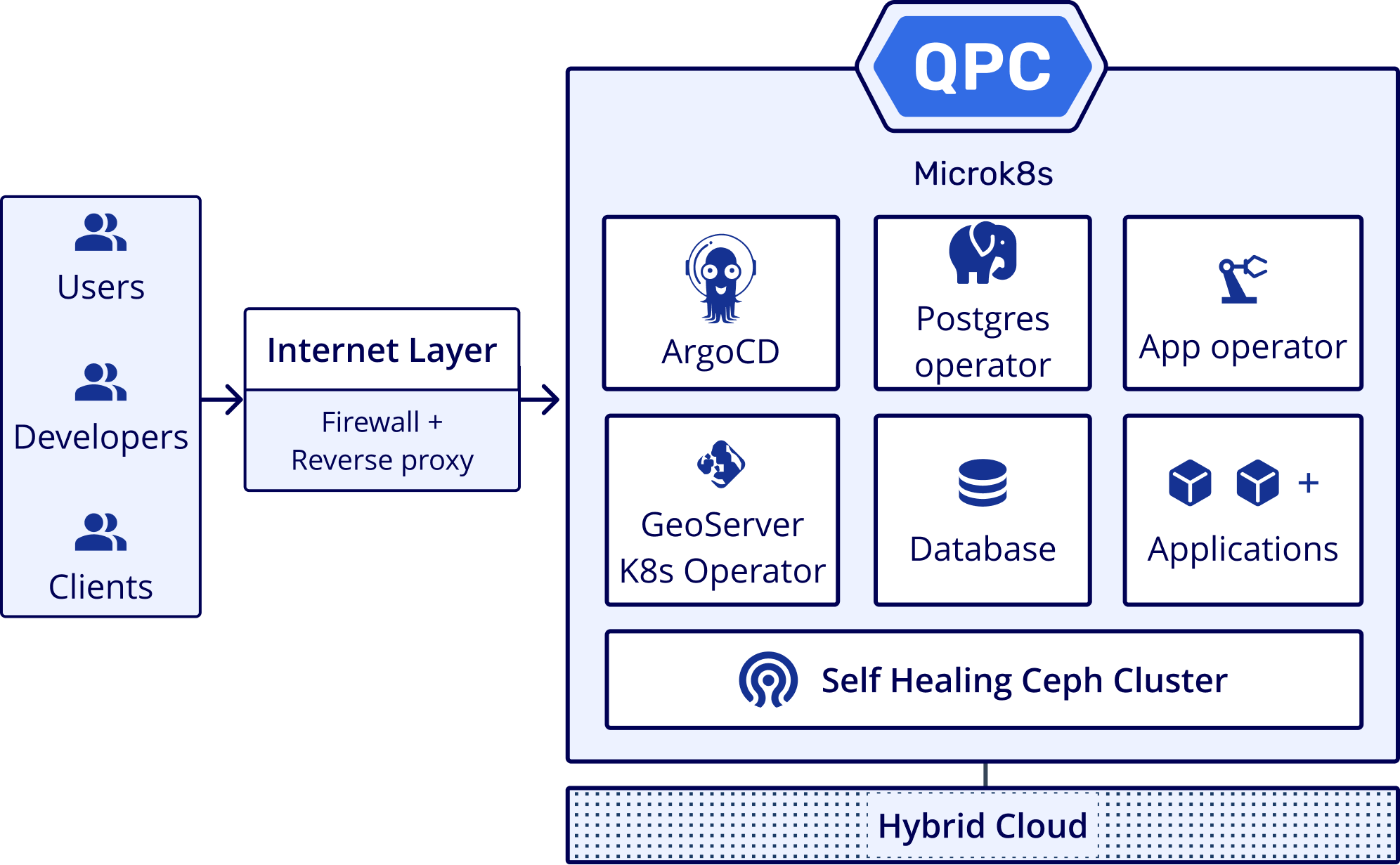
Quarticle provides security as a foundational layer across its entire geospatial intelligence stack. The platform is designed for regulated, data-sensitive environments where control, isolation, and traceability are critical.
Security is embedded into the architecture, from infrastructure to data access and application delivery. Key security capabilities include:
Fine-grained role-based permissions to ensure users and services only access what they are explicitly authorized to use.
Kubernetes-native deployments with hardened configurations for private, hybrid, and cloud environments.
Logical and physical separation of workloads, supporting multi-tenant and single-tenant deployment models.
End-to-end encryption for data in transit and controlled encryption mechanisms for sensitive spatial datasets.
Centralized enforcement of security, compliance, and access policies across all geospatial services and APIs.
Full visibility into system access and operations to support regulatory and internal compliance requirements.