

Site Risk Assessment: Moving Flood Analysis to the Building Level

Flood risk in insurance is often assessed at an aggregated level: by postcode, hazard zone, or site boundary. This provides a general indication of exposure, but it rarely reflects how losses actually materialize. In practice, losses occur at the level of individual buildings.
Within a single industrial site, exposure is not evenly distributed. One structure may remain largely unaffected during a flood event, while another can experience significant damage. Treating the entire site as a single unit hides these differences.
What Site Risk Assessment Does
The Site Risk Assessment feature addresses this gap by shifting the analysis to the building level. It allows entire sites such as manufacturing facilities, logistics hubs, or campuses to be assessed as individual structures rather than as single entities.
Building footprints are automatically intersected with flood hazard layers, and flood depths are calculated for each structure across multiple return periods, such as 1-in-50, 1-in-100, or 1-in-150 year events. The result is a more granular view of how flood risk is distributed across a site.
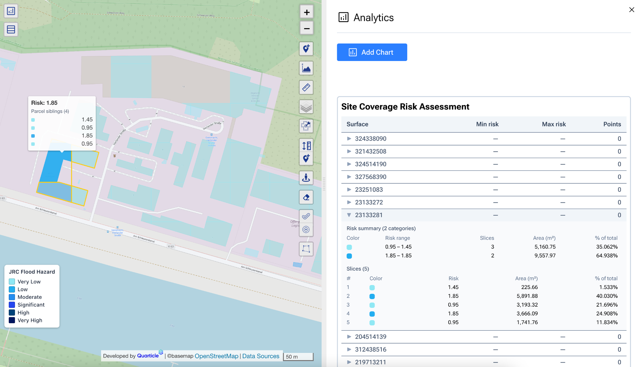
From Location-Based to Structure-Based Risk
This level of detail changes how risk can be understood and evaluated. For insurers, the relevance goes beyond location alone. The impact of a flood depends not just on where it occurs, but on what is affected.
Two buildings within the same site can differ in:
- elevation
- proximity to water bodies
- construction type
- usage and stored assets
By combining building-level flood depth with information about building use, it becomes possible to link hazards directly to assets. This supports a more realistic view of potential damage under different scenarios, rather than relying on generalized assumptions at the site level.
Practical Implications for Underwriting
From an underwriting perspective, this leads to more differentiated assessments. Instead of assigning a single risk profile to an entire location, exposure can be evaluated on a structure-by-structure basis. This improves the basis for estimating losses and provides a clearer understanding of where risk is concentrated.
It also makes risk mitigation more targeted. Rather than applying broad measures across a site, attention can be focused on the buildings that contribute most to potential loss. In practice, this might mean reinforcing flood protection in specific areas, adjusting the placement of critical equipment, or reconsidering how certain buildings are used.
For a closer look at how Site Risk Assessment works and how the analysis is structured, you can watch the full walkthrough here.
