
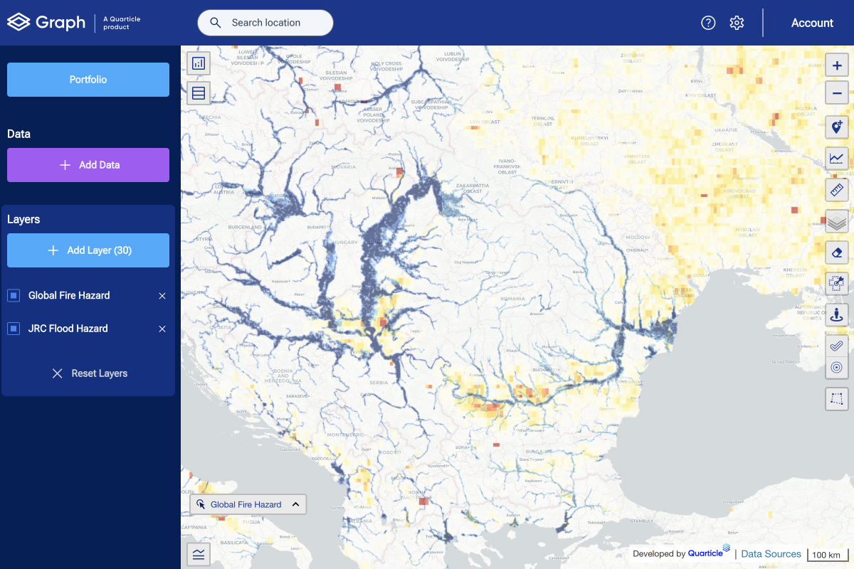
International Disaster Risk Reduction Day: Leveraging GIS for a Safer Future
International Disaster Risk Reduction Day, celebrated every year on October 13th, emphasizes the critical need for proactive strategies to mitigate the effects of natural hazards.
Debunking 5 Common Myths About GIS Technology in the Insurance Industry
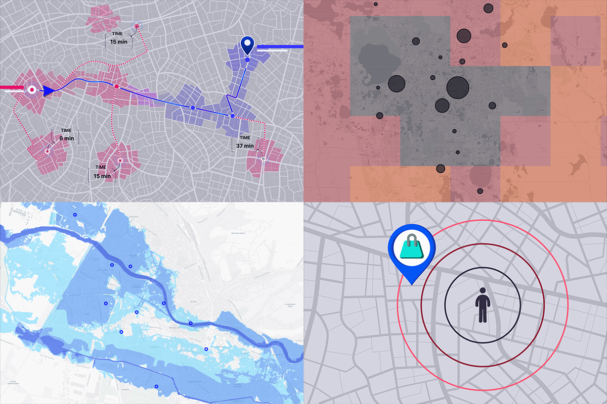
Exposure management is crucial for insurance companies to maintain sufficient capital against catastrophic losses. Without carefully balancing their exposures and capital, a single catastrophe can put a company out of business.

How Cloud Solutions Enhance Geospatial Data for Business and Beyond
Data generation is accelerating at an unprecedented rate, with billions of data points being created every hour. As this continues to be produced around the globe, geospatial data is increasingly important for many businesses.
Geocoding APIs: The Key to Modern Geospatial Analysis and Applications
Geocoding APIs are essential tools for businesses and organizations that rely on location data. These APIs allow developers to convert addresses and other location information into geographic coordinates, facilitating geospatial analysis, visualization, and mapping applications.
GIS for Everyone: Implementing Accessibility Features
In the realm of Geographic Information Systems (GIS), accessibility has become a crucial yet often overlooked aspect. While GIS technologies have revolutionized spatial data analysis and visualization, a significant gap exists in ensuring equal access for all users.

Understanding Formats and Coordinates in Geospatial Data
The smooth integration of geographic information in applications such as Google Maps and the precise calculations powering GPS systems highlight the significant advancements made in the field. However, understanding the various geospatial data formats and coordinates remains a complex task.

6 Steps to Take Before Reaching Out to GIS Solution Providers
Are you intrigued by the potential of Geographic Information Systems (GIS) but unsure where to start? GIS technology offers a powerful set of tools for analyzing and visualizing spatial data, but approaching a solution provider can feel intimidating.

Global Recycling Day: 7 Ways GIS Impacts Current Recycling Initiatives
Every year, March 18th marks Global Recycling Day, a worldwide focal point for promoting sustainable waste management. GIS and our current knowledge around recycling practices offer a powerful unity to increased environmental consciousness.